Submit the following information and we'll be in touch with you shortly!

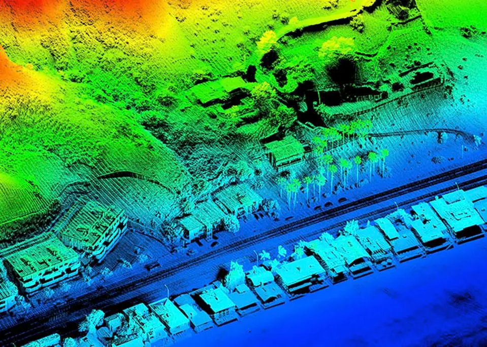
3D GIS Data Mapping: Our 3D GIS data mapping service is a comprehensive solution that utilizes advanced geospatial technologies and software to create highly accurate and detailed 3D models of real-world objects and environments. In addition to LiDAR data, we also use other geospatial data sources such as satellite imagery, aerial photography, and field surveys.
Our 3D GIS Data Mapping service provides high-quality, visually rich 3D models of geographic data, including LiDAR data, using advanced 3D modeling techniques. We use cutting-edge software and tools to create accurate, detailed 3D maps and models that allow you to view, analyze and manipulate data in a fully immersive 3D environment. Our 2D to 3D conversion services enable you to take your existing 2D data and turn it into a 3D model, providing you with a new level of depth and detail.
In addition, we provide feature extraction services using various software, including machine learning techniques for automated identification of important features within the data. This allows for efficient and accurate extraction of relevant information from your data, enabling you to make more informed decisions. Our 3D GIS Data Mapping services are highly customizable and can be tailored to meet the unique needs of your business or organization, whether you require 3D models for planning, analysis, or visualization purposes.
Our 3D GIS data mapping service can be used for a variety of applications, such as urban planning, environmental monitoring, infrastructure development, and disaster management. By using machine learning algorithms, we are able to extract features from the geospatial data with high accuracy and efficiency, resulting in more detailed and accurate 3D models.
We also use the 3D models to create interactive virtual environments, which can be used for immersive training, education, or public engagement. These virtual environments can simulate real-world scenarios and provide a more engaging and impactful way to communicate complex spatial data.
With our 3D GIS data mapping service, businesses can leverage the power of advanced geospatial technologies, LiDAR data, and machine learning algorithms to gain new insights from their data and gain a competitive edge in their industry. Our experts have extensive experience in 3D GIS data mapping and are committed to delivering high-quality results that meet the specific needs of our clients.
Our team of experts is equipped with the latest geospatial technologies and software, and has extensive experience in providing 3D GIS data mapping services for a wide range of industries and applications. We work closely with our clients to understand their specific needs and deliver customized solutions that meet their unique requirements.